Points Along The Trail
Charleston, TN
Day One on the Trail of Tears.What is now Charleston, Tennessee began around 1808 when Major John Walker Sr., a part-Cherokee grandson of Nancy Ward, established a ferry across the Hiwassee River between present-day Charleston and Calhoun. As a result, the community was initially known as "Walker's Ferry." The Hiwassee Purchase of 1819 resulted in the cession of Cherokee lands between the Hiwassee and Little Tennessee rivers to the Federal Government, and as a result, the Hiwassee River became the boundary between the Cherokee Nation and the United States, where it remained until the Cherokee removal in 1838.
In 1821, the Cherokee Agency— the official liaison between the U.S. government and the Cherokee Nation— was moved to the location of present-day Charleston. The agent to the Cherokees was first Colonel Return J. Meigs Sr., who had served in the Revolutionary War, and later Joseph McMinn, who served as Governor of Tennessee from 1815 to 1821. Lewis Ross, the brother of Chief John Ross, constructed a home nearby in 1820, and established a trading post and store in the city the following year. Between 1832 and the Cherokee removal in 1838, the Red Clay Council Grounds in southern Bradley County, served as the final eastern capitol of the Cherokee Nation.
In the 1820s and 1830s, many white settlers began to move into the area anticipating a future forced removal of the Cherokee by the Federal Government. At times, these settlers came into conflict with the Cherokee, who resisted settlers who tried to take over their territory. After the passage of the Indian Removal Act of 1830, Fort Cass was constructed in Charleston as the headquarters of the Cherokee removal, which was initiated by the Treaty of New Echota in December 1835. During the summer of 1838, thousands of Cherokees from various locations were held in internment camps at the fort under the supervision of federal troops before starting their journey westward. Several other internment camps were located in the valleys between Charleston and present-day Cleveland, Tennessee over a distance of 12 miles (19 km), including one at nearby Rattlesnake Springs.

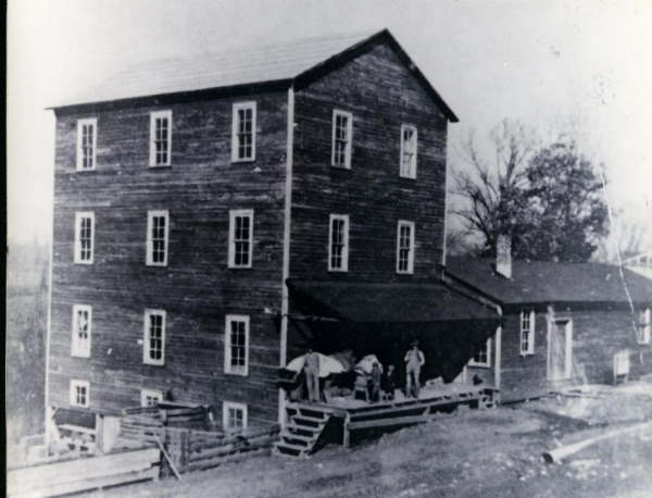
Andrew Hooper's Mill Located about 5 miles West of Charleston, TN
Source: "Reflections Past and Present 1836 - 1991 A Pictorial History - Bradley County, TN
Charleston, Tennessee is now a tiny town of about 600 people and off the highway. It has a museum and interpretive center, but since we were there on Monday, the center was closed. It should make an interesting day trip at another time as there are several very nice antique shops. (and a Mexican restaurant).
From Charleston, the Cherokee took three paths to Oklahoma, one due west through Memphis, one to the south through Alabama and the other north through Kentucky, Ohio, Illinois and Missouri. We are traveling the northern trail, identified on the map in red.
Source; Adapted fromWikipedia

 The Trail of Tears